
Trace a Hilton Head Island Street Directory Address
For a known Island address, the most defensible walk-through moves from geography to a recorded land document. It does not begin with a claim about who is currently at the address. Beaufort County maintains the tax-account and parcel tools for this Town in Beaufort County, while the Register of Deeds keeps the recorded land trail. The State Election Commission’s MySCVotes tool is a self-service registration path, not a public street view, so it cannot turn a by-address search into a voter roll or a household conclusion.
- Enter the address in Beaufort County Real Property Search and record the situs, PIN, legal-description clues, and account context.
- Open the County GIS map to compare the parcel’s displayed geometry, lot labels, jurisdiction, and nearby public features.
- Carry the PIN, lot wording, DMP, book/page, or instrument clues to the Register of Deeds rather than treating the property screen as a deed.
- Read the deed or plat index and image, noting its recorded date and the exact grantor, grantee, or legal-description terms used there.
- For older context, follow the dated archival route through SCDAH or the Beaufort District Collection without converting context into a current-person claim.
This sequence gives a street-by-street inquiry an audit trail. For Hilton Head Island, a property owner, a recorded party, and a mailing field are distinct record roles, and none alone identifies a current household.
Hilton Head Island Street Directory Property Search
The County’s Real Property Search is the practical first stop for an address-keyed Hilton Head Island record trail. It accepts one search criterion at a time. The County’s guidance favors less detail when a query is too narrow, which is useful for resolving the right parcel without assuming that a street label by itself is a complete legal identifier.
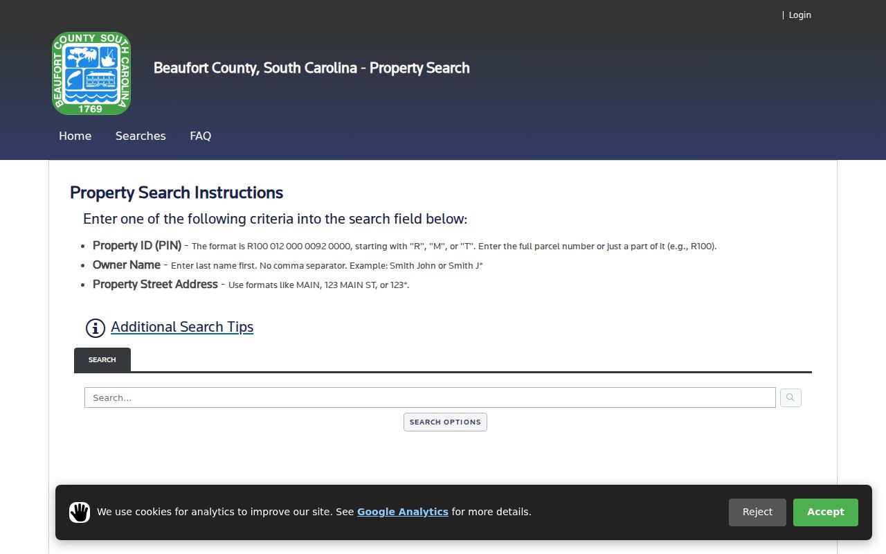
The screen is a route to an account, not a list of people. For Hilton Head Island address work, its property, location, mailing, tax, and sales context can supply identifiers for the next record layer.
| County search field | How the County says to enter it | Street-research use |
|---|---|---|
| Property ID (PIN) | Use a full value such as R100 012 000 0092 0000; a partial entry such as R100 broadens results. | Reconnect a known parcel to its account. |
| Owner Name | Enter last name first, with no comma; the County gives Smith J* as a wildcard example. | Cross-check an owner-of-record field after the parcel is identified. |
| Property Street Address | Try MAIN, 123 MAIN ST, or 123*; fewer terms broaden a result set. | Find a candidate situs and PIN from a known address. |
County help says the service may show values, location, mailing address, taxes billed or due, sales context, and related account data. It does not display a household roster. A mailing destination is for correspondence and must not be recast as occupancy.
Hilton Head Island Parcel and GIS Bridge
Use the Beaufort County GIS hub as a geographic cross-check after finding a candidate property account. The published AddressParcels service exposes fields including PIN, lot_num, gis_area, gis_acres, DMP, jurisdiction, and spatial geometry. Those field names describe the map layer; they do not promise that every display is complete or that web geometry is a survey.
DMP, PIN, and lot wording can form a useful bridge. The ROD’s recording guidance says deeds and plats need a Department of Mapping and Platting number. Preserve the PIN, DMP, lot wording, and legal description as separate clues, then use the one that the recorded index accepts. Do not collapse a subdivision label into a legal description simply because both appear near the same address.
For this record task, compare the map’s parcel shape and surrounding labels with the tax display before making a place statement. Across Hilton Head Island, a line that looks adjacent on screen may be a road, water feature, common area, easement, condominium regime, or generalized boundary. The recorded plat and legal description are the next sources when the map alone is unclear.
Hilton Head Island Deed Search Route
After the property and GIS steps, use the Beaufort County Register of Deeds advanced search to work from document facts instead of a loose street-name match. Its public controls include party, grantor, grantee, recorded-date range, document-type filtering, book, page, legal-description, parcel-number, and document-image search fields. A recorded land document can establish that an interest was recorded; it is not proof of current presence at the situs.
When a Hilton Head Island property card displays book, page, sale date, instrument shorthand, or owner history, treat those as bridges to the ROD record. Check the actual index or image, retain the recorded date, and distinguish a return or mailing field from the physical address. The ROD does not perform an official title search. It can supply copies when the document is identified, at $0.50 per page plus actual postage, or $10 for certification.
For an unposted County department record, the County FOIA process offers online and mail routes, but it is not an end-run around the ROD. County guidance directs deed, easement, mortgage, plat, survey, and lien requests to the Register of Deeds first. SCFOIA provides access to existing public records subject to exemptions; it does not require an office to create a new street list or resolve a title question.
Hilton Head Island Street Directory Older Index Tips
Beaufort County’s older land trail has search methods that a modern address box will not reveal. ROD instructions say to select document type INDEX for handwritten grantor/grantee or mortgagor/mortgagee index books, using the recorded heading that fits the document. Names are entered last name first in the browser-view path. When an older plat is the better lead, search OLD PLAT by name and carry the plat’s lot or block notation into the conveyance search.
That technique is useful when a Hilton Head Island street name does not surface a document. It is a document-retrieval method, not a shortcut to a person list. Record the book, page, reel, plat name, date, and limitation found in the source, then let the earlier recorded party, legal description, or reference direct the next search.
Hilton Head Island’s 2026 ROD Search Split
Beaufort County changed its Register of Deeds provider in February 2026. The current Neumo public search is the converted/current route from February 23, 2026, while legacy New Vision coverage reaches through February 19, 2026. The County also reported a temporary closure during the conversion window. For a street history, note which system and date range were checked rather than calling either search a complete historical run.
The transition matters most for Hilton Head Island research at the boundary between older and current indexing. A missing web result can reflect the system split, a spelling difference, an older handwritten index, or an incomplete search key. First retry with the parcel, legal-description, party, book/page, or recorded-date facts available from the prior step. Then use ROD copy assistance or the archival series where the online route stops.
Hilton Head Island Street Directory Record Coverage
Each source answers a narrower question than the phrase “who lives on a street” suggests. The following address-keyed coverage keeps the record purpose visible and prevents an owner, permit contact, or map label from being misdescribed as a current resident record.
| Address-keyed source | Custodian | What it can show | Access route |
|---|---|---|---|
| Real Property Search | Beaufort County property service | PIN, situs, property and tax context, mailing field, and sales references | Public online search; Assessor handles real-property questions. |
| GIS AddressParcels layer | Beaufort County GIS | Parcel geometry and map attributes such as PIN, lot number, DMP, area, acres, and jurisdiction | GIS hub and County ArcGIS applications. |
| Recorded deeds and plats | Beaufort County Register of Deeds | Recorded transaction, legal description, plat, parcel, and book/page context | Current and legacy public search, copy request, or in-person office route. |
| Town CSS map | Town of Hilton Head Island | Publicly posted permit or plan case context attached to an address | Map/address search, Town staff, records request, or meeting archive as appropriate. |
| Historical research collections | SCDAH and Beaufort District Collection | Conveyance, plat, map, newspaper, and local-history context by date | Archives finding aids and in-person research-room access. |
MySCVotes is intentionally absent from this table as a Hilton Head Island street source. Its form requires a county, first and last name, date of birth, and last four Social Security digits for an individual’s own registration path. It does not provide a public browse view by street, neighborhood, or ZIP.
Hilton Head Island Street Directory Terms to Keep Separate
These short terms help keep the evidence chain precise. They are particularly important on an island where Town, County, postal, planned-community, and historic place labels can overlap without meaning the same thing.
Parcel: the mapped or assessed land unit, often keyed by a PIN. Situs address: the physical property location used in the account. Plat: a recorded map that can describe lots, blocks, or subdivision geometry. Criss-cross directory: an address-to-name reference format when a dated volume is actually located and inspected.
No verified printed Hilton Head Island city-directory run was located in the research. A criss-cross directory is therefore a library inquiry lead, not a promised Island-wide source. For Hilton Head Island historical work, the Beaufort District Collection and Heritage Library can help identify dated material, but an entry needs its publication year, source, and limitation recorded before it supports any conclusion.
Hilton Head Island Street Directory and Town CSS Limits
Town Customer Self Service, also called EnerGov, has an address-search map for public permit and plan case context. The Town manual describes choosing an address in the map search, then opening available blue case numbers for more detail. That can be useful for a public development timeline or a planning-file lead after a parcel is known.
It is not a title system or a current-address system. A Hilton Head Island permit applicant, contact, dashboard user, or case participant may have a role in a posted project without holding title or living at the site. For an item not posted in CSS, use the Town’s staff or records-request channels and identify the record, date range, and department. Do not attempt to bypass account-only material.
Hilton Head Island Address Archive Gaps
Historical address research in Beaufort County needs an honest stop point. SCDAH documents major County record losses after removal to Columbia in February 1865. That context means an early missing item may reflect record survival rather than the absence of a transaction or place. Do not make a seamless story from a modern property account when the dated chain is incomplete.
The next documented route is specific: SCDAH lists 59 reels of Beaufort conveyance microfilm for 1863 through 1926 and three reels of plat microfilm for 1868 through 1920. The Beaufort District Collection adds Hilton Head Island maps, microfilm, genealogy, and local-history resources; its current page lists weekday hours and recommends appointments. Later context may also appear in Harman Collection microfilm for 1960 through 1990 or Island Packet microfilm from 1970 through March 2015, but neither replaces title evidence.
Limits of a Hilton Head Island Street Directory
A mailing field is not a resident field. The County property account can show a correspondence address, a recorded document can name a party, and Town CSS can show a project contact. None establishes present occupancy, a household relationship, or a person’s routine. Driver and vehicle data have separate legal protections, and public parcel research is not a substitute route to them.
Use a Hilton Head Island street record trail for lawful property history, public-document verification, or place-based research. If a record appears wrong, take the correction to the Assessor, Auditor, Treasurer, ROD, Clerk, or other actual custodian. Do not republish sensitive identifiers, use public availability to track someone, or treat a missing address as proof that a protected program applies.
Lawful use. Hilton Head Island public address records are not permission to surveil, repeatedly contact, threaten, or harass anyone. South Carolina’s stalking and harassment rules apply, and an immediate safety concern belongs with emergency services, not a records search.