
Map Hilton Head Island Neighbors by Block
A public block inquiry on Hilton Head Island should describe parcels, recorded land documents, and map context, not produce a nearby-person list. Beaufort County’s systems are useful because they separate an address-based property account from the GIS geometry around it. The ROD can then supply the recorded deed or plat context. The table below keeps each source within that evidence boundary and includes the channels available when a web result is incomplete.
| Source | What It Shows About a Block | Access |
|---|---|---|
| County GIS and AddressParcels layer | Parcel geometry, lot/PIN/DMP attributes, jurisdiction, and adjacent map features | Free County GIS hub and ArcGIS applications |
| County Real Property Search | A candidate property account, situs, property/tax context, mailing field, and sales references | Free public portal; Assessor route for account questions |
| Register of Deeds index | Recorded deeds, plats, legal descriptions, parcel clues, and book/page references | Current and legacy online routes, copies, and in-person ROD access |
| Town CSS map and records | Public address-linked permit or plan case context | Map search, Town staff, records request, and meeting archive where applicable |
| SCDAH and local-history collections | Historic conveyance, plat, map, and dated place context | Archives finding aids, research room, and library inquiry routes |
None of these sources is a current-neighbor directory. In Hilton Head Island records, property data ties to an assessed parcel, and a tax mailing field is correspondence information. They can support a narrow statement about the parcel or document, but not a conclusion about who lives nearby.
Hilton Head Island Neighbors Begin with a Parcel
Start at the Beaufort County Real Property Search with one known address. The County accepts a Property ID, owner name, or property street address, one criterion at a time. Street input can be broad or narrow: its examples include MAIN, 123 MAIN ST, and 123*. A partial PIN can also broaden a result. Use those options to resolve the candidate property, not to sweep an entire block for names.
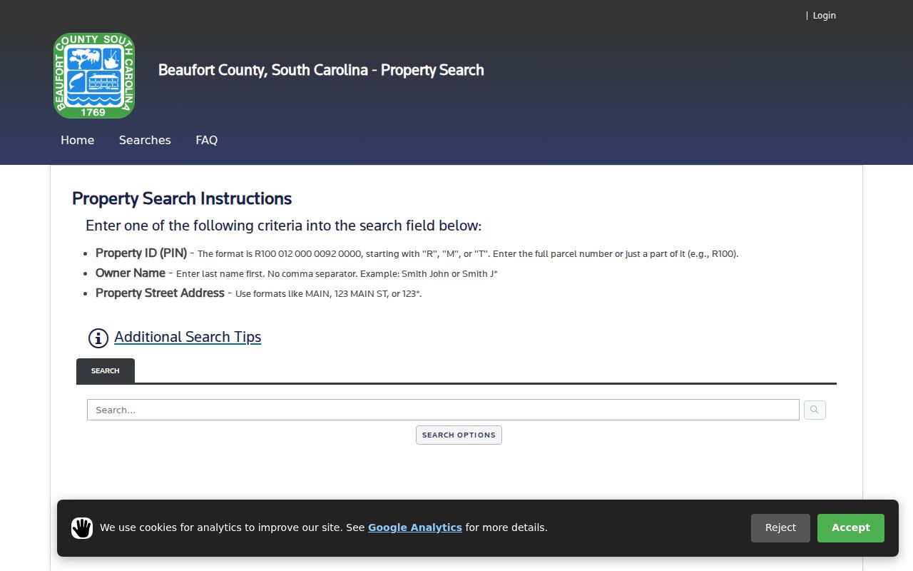
The property result can provide a situs, PIN, legal-description clues, values, taxes, sales context, and a mailing field. Those are useful Hilton Head Island routing facts. The portal does not enumerate a household, and its mailing field does not establish occupancy at the Island address.
Hilton Head Island’s DMP/PIN Clue
PIN, DMP, and lot wording can connect maps to documents. The County’s AddressParcels feature service publishes fields such as PIN, lot_num, gis_area, gis_acres, DMP, jurisdiction, and geometry. The ROD’s recording guidance says a deed or plat needs a Department of Mapping and Platting number. That creates a useful, but limited, bridge between the assessed account, the map, and a recorded land document.
Keep the identifiers separate in notes. A DMP might lead to a recorded item; a PIN can reconnect the map to the County account; a lot label can help interpret a plat. A subdivision name, a postal label, and a legal description may overlap, but they are not interchangeable. The correct result is an evidence trail for a place, not a profile of nearby land.
Map Hilton Head Island Neighbors Through Adjacent Geometry
Once the candidate parcel is confirmed, open the Beaufort County GIS hub and inspect the corresponding map feature. The County map is a geographic cross-check, not the authoritative deed book. Treat the nearby geometry as a prompt to inspect public land records and place labels, with the check date and layer noted beside any conclusion.
- Locate the known address or PIN and record the displayed parcel, lot wording, jurisdiction, and map layer used.
- Inspect surrounding parcel shapes only to understand map adjacency, preserving parcel identifiers rather than contact data.
- Compare the property account and map attributes, including any DMP or legal-description clues.
- Use a recorded plat, deed, book/page, or parcel search at ROD to test a lot, subdivision, easement, or transfer statement.
- For a whole named street’s document chain, use the separate Hilton Head Island by-street record guide rather than expanding a block check into a person list.
Map adjacency is not social adjacency. On Hilton Head Island, a visual shared edge can be a right-of-way, water, common area, private road, condominium regime, or generalized line. A real boundary issue requires the recorded plat or survey and appropriate professional advice.
Hilton Head Island Recorded Plats
The ROD advanced search has party, grantor, grantee, recorded-date, document-type, book/page, legal-description, parcel-number, and document-image controls. Use legal-description, parcel, book/page, or date clues from the prior step to find the document that describes land. A plat can help establish lot, block, subdivision, or easement context; it does not identify a present household.
If an older Hilton Head Island record does not respond to a modern search, ROD instructions direct researchers to document type INDEX for handwritten grantor/grantee or mortgagor/mortgagee books. Search OLD PLAT by name for historic plat leads. Record the document type, recording date, book/page or document number, and the exact legal-description wording. That preserves a defensible block history without treating a mapping clue as a conclusion.
Hilton Head Island Neighbors in Historic Geography
The Town’s historic-neighborhood map adds an important place layer for the Island. It names Squire Pope, Little Stoney, Big Stoney, Jonesville, Jarvis, Old House Creek, Spanish Wells, Gardner, Baygall, Mitchelville, Big Hill, Grassland, Marshland, and Chaplin. These are Town-documented historic Gullah Geechee community names that can orient a map or a local-history question.
Historic geography is not membership data. Use a Town map or plan to say that a source places a parcel within or near a named historic geography only when the source actually does so. Do not infer a person’s ancestry, race, economic position, family connection, or current residence from proximity to one of these communities. Where another source uses a different Town, County, postal, or planned-community label, preserve the distinction.
Hilton Head Island Neighbors and the Association Directory Gap
No current official Town or County master directory of neighborhood-association membership, contacts, or boundaries was located in the research. That absence is useful information. Planned communities, property associations, and civic groups may publish their own material, but a private or member-only directory is not a County public-record source and should not be used to assemble a people list.
| Community-source question | Confirmed public route | Boundary to preserve |
|---|---|---|
| Is there a Town or County master association roster? | No official master roster or membership directory was located. | Do not fill the gap with private membership information. |
| Is there an official geography source? | Town historic-neighborhood map, County GIS, and recorded planning or land documents. | Geography does not prove association status or personal connection. |
| Is there a current group fact to verify? | Use that group’s own current public governance document or a dated Town-recorded planning document. | Avoid member names, personal contacts, and unstated boundaries. |
This route keeps a Hilton Head Island block feature about documented place and public records rather than speculation about who belongs to a group.
Hilton Head Island Neighbors: Official Records and Commercial Categories
Official parcel layers are strongest when the question is physical geography: which mapped land unit is displayed, what identifier it carries, and which recorded document may describe it. County property records add assessed-account context, while ROD documents add a dated land-record trail. Each has a named custodian and a correction or copy path.
Commercial neighbor-lookup categories commonly combine data from varied sources and may sort or present it as if it were a current social map. That presentation can blend an old address, a mailing field, an entity record, or a weak name match. For a Hilton Head Island block question, prefer the official parcel layer and the underlying recorded document, then describe only what the source can actually support. Do not use a commercial category as proof of current presence or a reason to contact someone.
Hilton Head Island Town CSS Limits
Town Customer Self Service, also known as EnerGov, offers a public map route for available permit and plan records tied to an address. The Town’s manual describes selecting an address in the map search and opening blue case numbers when available. That can add public development or planning context after a parcel is known.
It does not establish title or a current personal connection to the address. A Hilton Head Island permit applicant, project contact, or account dashboard user has a case-related role, not an automatically continuing relationship to the location. For a nonposted public item, use Town staff, a focused Town records request, or the Town Clerk meeting archive. Account-only areas should not be bypassed.
Privacy Limits on Hilton Head Island Neighbors
A parcel or mailing field is not a resident list. Parcel boundaries are land units. An owner or recorded party is named in a particular account or document. A mailing address is a delivery field at a point in time. None proves present occupancy, household composition, access rights, or a person’s daily routine. There is also no observed public nearby-voter interface: MySCVotes is an individual self-service tool, and the statutory voter-list sale process is not a neighborhood-search feature.
South Carolina’s Address Confidentiality Program provides a designated-address mechanism for qualifying participants, and protected material has separate treatment. Do not try to reconstruct a protected Hilton Head Island location from other records. SCFOIA is an access law for existing public records subject to exemptions, not a force-creation tool or an end-run around privacy safeguards. Send an apparent property or map error to the County custodian that maintains the field.
Lawful use. Public map and land records are for lawful place-based research, public-document checks, and historic context. They are never permission to surveil, repeatedly contact, threaten, harass, or harm another person.